
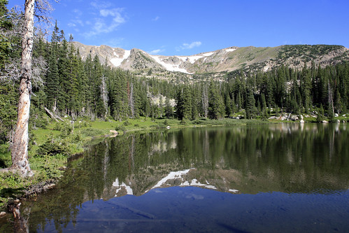
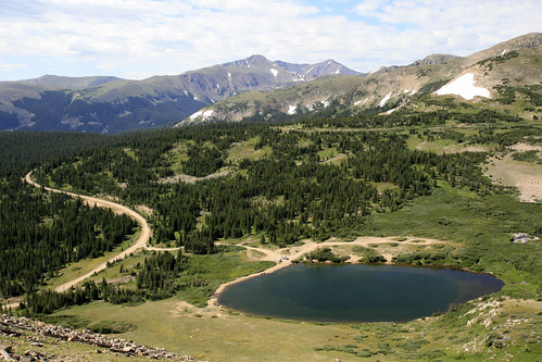
A four mile hike through the woods on the Forest Lakes Trail would bring me to the 4WD road, just below treeline. It was a perfect morning when I reached the first lake, as the Continental Divide was reflected in the calm waters. As I got close to the bank a trout darted away, startled by my approach and in fear (I'm sure) of my fishing prowess.
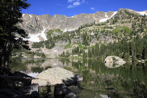
A little further up the trail and closer to the mountains, I passed the second Forest Lake.
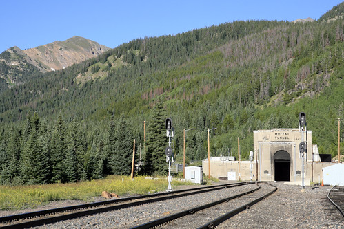
Soon afterwards, I passed the wilderness boundary and the trail ended at the old railroad grade. Luckily a short distance later, a large snowdrift was still blocking the road, so no ATV's or 4x4's could pass. I had a great view of Needles Eye Tunnel and Jenny Lake as I followed the old railroad grade up the mountainside.
As I got above treeline, I saw the first of many skittish marmots living near the old roadbed. This guy was making sure I wasn't really hunting him:
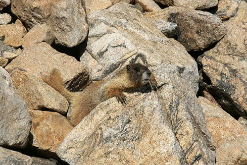
As I walked along I heard many "whistle pigs" (as marmots are sometimes called) alerting others to my presence. Quite a few darted across the roadbed in front of me and into the safety of their dens. While walking through a rock cut, an unseen marmot whistled at me, causing me great fright as the shrill call echoed off the rocks and left quite a ringing in my ears.
I finally reached Needles Eye Tunnel and climbed above it. Here is the view from the tunnel, looking down at Jenny Lake, the old railroad grade, and James Peak in the far distance:
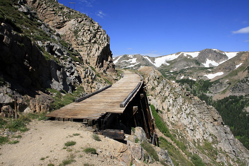
Past the tunnel, you can keep following the old railroad grade to the abandoned Devils Slide Trestles. Many years ago, you could still drive a car through the tunnel and across these bridges.
I finally reached Rollins Pass, also known as Corona Pass (Spanish for crown), a short while later. Apparently the small settlement that once existed on top was known as Corona because it was supposedly the "crown of the world." I took a shorter route back, cutting across the mountain instead of following the winding road. While considerably shorter in mileage, it was of course, more strenuous. After 14 or 15 miles of hiking, I got back to the car exhausted and headed home to Boulder. Once I got back, I couldn't find the sandwich I was so looking forward to in the fridge; I later learned Laura had eaten it after I left. D'oh!!!
James- I think the tunnel picture is creepily reminiscent of the tunnel pictures we have from Whittier, Alaska---- (cue the twilight zone music!)
ReplyDeleteAlso- I am supremely jealous of the "physical fitness" that you guys have----it is NUTS that you can jaunt off for a 15+ mile daily hike at or near 14,000 feet.
NUTS.