
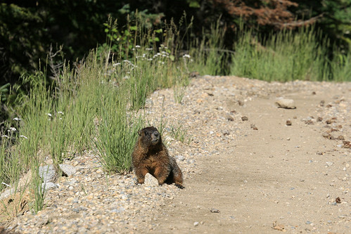
Further up the road, I evaded this furry toll collector with some deft street-racing moves in Laura's '95 Geo Prizm.
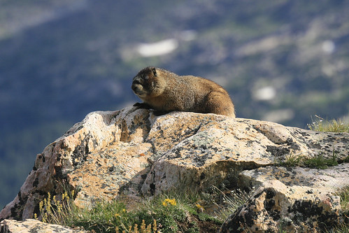
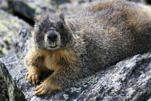
At Chapin Pass, I decided to embark on an impromptu hike up to the tundra, which, quickly evolved into a climb of Mt. Chapin and Mt. Chiquita. At a switchback in the trail, I met this marmot standing guard near treeline.
To my surprise, the upper slopes of Mt. Chapin were full of pikas!!
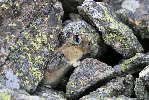
For those who don't know, pikas are lagomorphs; they are most closely related to rabbits and hares, which constitute the other family (Leporidae) within the order Lagomorpha. They are not rodents. Pikas live above treeline in boulder fields and talus slopes near suitable vegetation for feeding. Since they do not hibernate, they must harvest grasses and flowers which, they then dry and store as hay for the winter months.
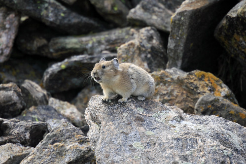
After approaching this pika, he sounded the alarm: a distinctive high pitched sound that marmots also listen for to help warn them of danger. The next pika I saw (below) was very well camouflaged.
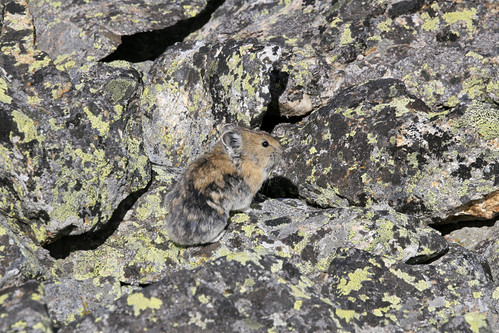
This was definitely the best pika viewing since we moved to Colorado. I've had a hard time shooting them, as they are small and fast, and unlike marmots, they don't seem to like posing much. Today was much better; I even saw one transporting a big wad of grass and flowers in its mouth, but unfortunately, I was unable to get a picture.
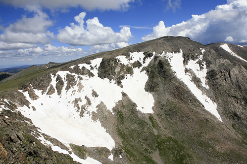
I decided to climb the higher and further Mt. Chiquita first, as I didn't see a good trail leading up to the summit of Chapin, plus the path I was on was leading me in that direction anyway. Here is a view of Chiquita from the south:
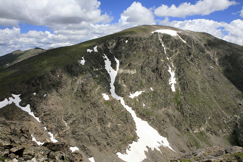
At 13,069 feet, Chiquita is the shortest 13er in the park, and also the easiest to climb (via the Chapin Pass route I was on). It's only a little over 2,000 feet of elevation gain and about 3 miles to the summit. As I climbed the more gentle west side of the mountain, the abundant pikas began to disappear, replaced by their high mountain brethern: marmots!!
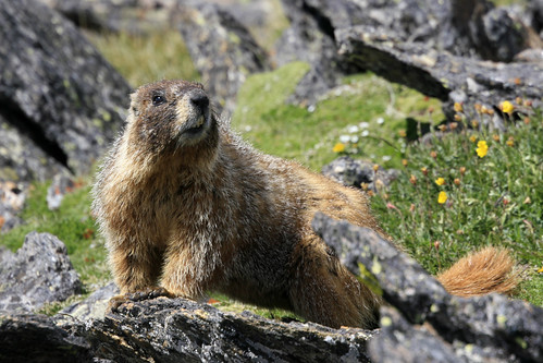
This guy was straight chillin' near the summit:
Once at the summit, Mt. Ypsilon looked tantalizingly close. This is part of the route we hope to hike in a couple of weeks called "Mummy Mania" or "Mummy Kill." It's a one way traverse which involves 6 (or more) summits in the Mummy Range.
I had already made good time up Chiquita, and Ypsilon (at 13,514 feet) didn't seem that far away. What could possibly stop me from adding another summit to this totally unplanned hike...?
No comments:
Post a Comment