Thursday, July 28, 2011

Elusive Pikas

Tuesday I ventured into RMNP to climb Sundance Mountain.  It was the first time I had been in the park since July 17th when Laura and I climbed Storm Peak with our friend Aaron.  After bushwhacking up Storm Peak, we had our planned ascent of Mt. Lady Washington cut short by an approaching storm.  Here is the view from the summit of Storm Peak with the massive north face of Longs Peak towering above us:

IMG_1763a by typebangin

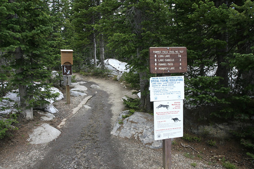
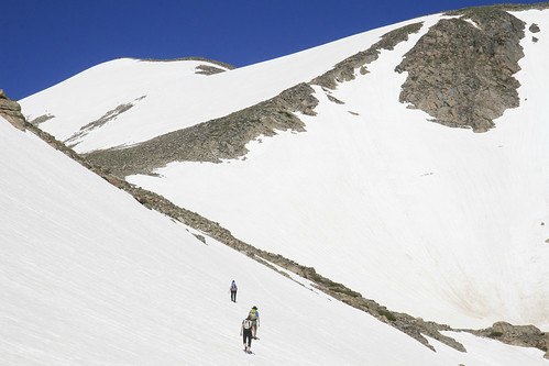
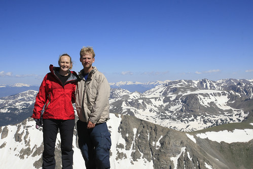
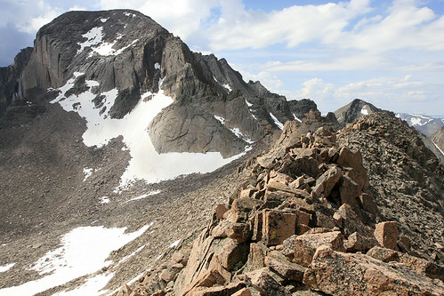
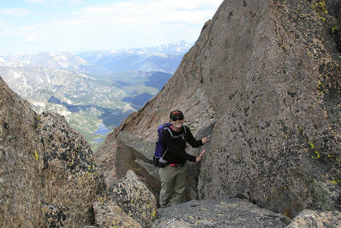
We navigated the ridge towards the Keyhole (the easiest route used to climb Longs Peak) and then descended into the Boulderfield.

IMG_1764a by typebangin

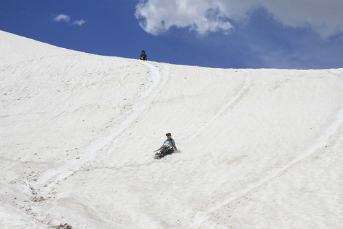
While Mt. Lady Washington was tantalizingly close, we made the wise decision to head back via the Longs Peak Trail.  While we made as fast a descent as possible, we were still caught in the thunder and lightning hailstorm for over 2 hours on the way down, as there are many miles of trail above treeline.  With every step I took, my not-at-all waterproof boots expelled water like a saturated sponge.  Needless to say, due to the wet and miserable nature of the hike, I didn't take any more photos that day.

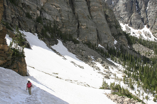
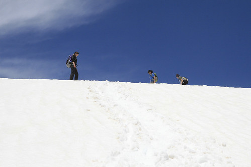
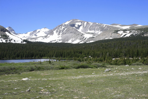
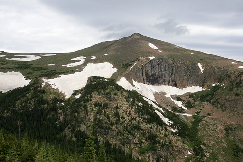
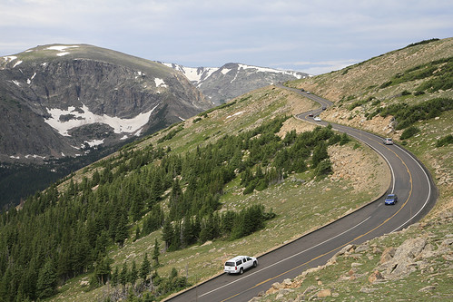
The weather in the mountains wasn't looking promising Tuesday as I approached Sundance Mountain.  The easiest way to climb this mountain is from Trail Ridge Road, as it's only about a mile and 1000 vertical feet to the eastern summit.  I parked opposite the Ute Trail and bushwhacked towards the summit (there is no trail).  The approach is from the left in the photo below.

IMG_1946a by typebangin

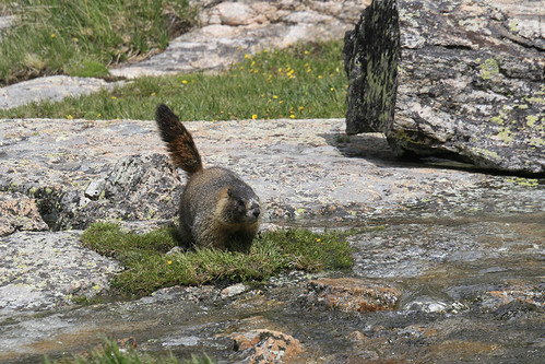
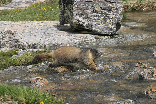
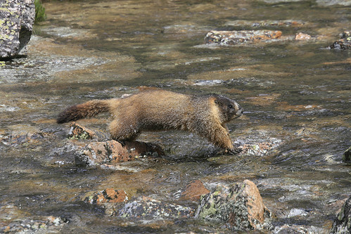
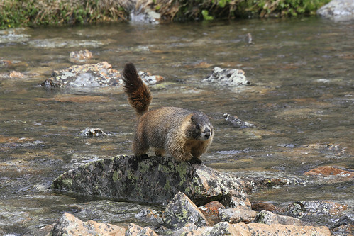
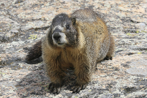
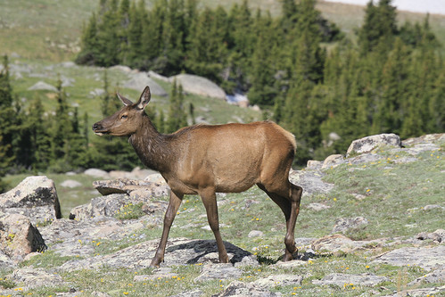
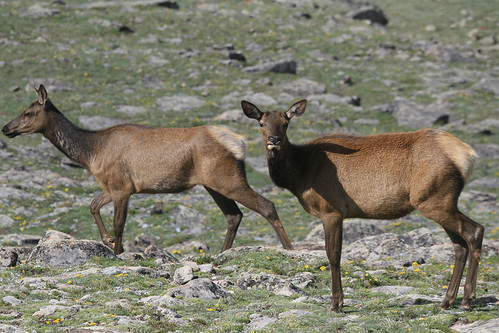
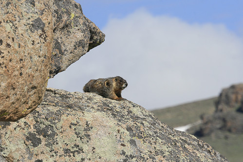
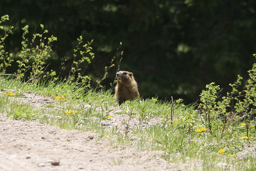
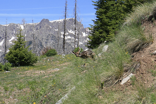
Because this is an easy climb, my real goal was finding beasts.  I thought I had seen some elk up on the tundra, but if so, they were gone by the time I got there.  Luckily, I found a couple of fatties kickin' it in a rocky area.

IMG_1845a by typebangin

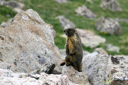
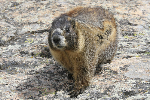
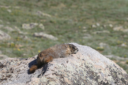
This guy was peepin' things when I showed up, no doubt unaware of my harmless nature.  After a while I looked over towards his nearby chill buddy, and lo and behold, he was yawning!!

IMG_1854a by typebangin

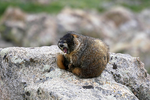
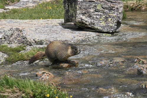
No morning coffee for this marmot!!

Once I reached the eastern summit, I stupidly sprained my ankle while boulder hopping.  I decided to abandon the traverse to the western summit of the mountain at that point, as it was going to take longer with a bum ankle and the weather didn't look promising.

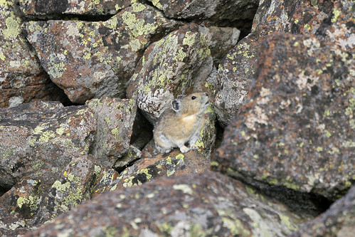
On the way down I heard some pikas and decided to try and get some photos.  So far pikas have been much less cooperative than marmots.  It took me a long time to spot this guy, as he kept calling, then ducking behind the rocks.

IMG_1860a by typebangin

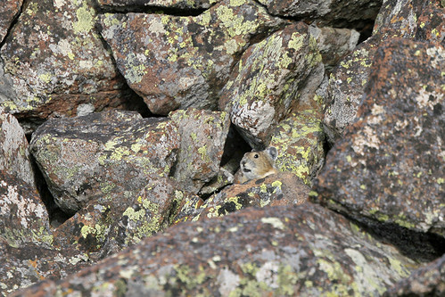
This was shot with my telephoto lens and then cropped; you can imagine how hard it is to spot one of these guys.  I was able to get a little closer, and got one more picture of him sounding the alarm before he darted away.

IMG_1861a by typebangin

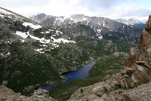
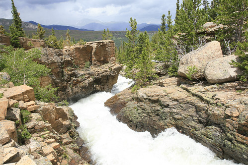
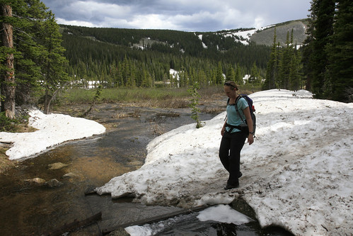
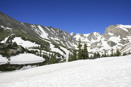
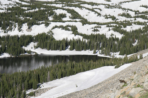
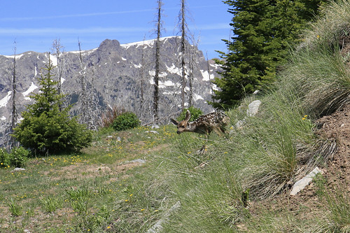
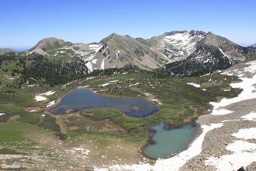
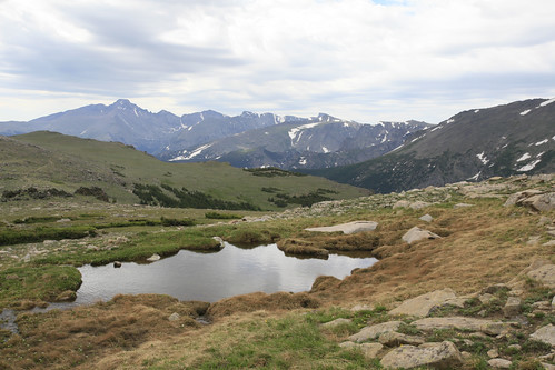
On the way back, I passed this tarn with views of Longs Peak and the Continental Divide in the distance.

IMG_1873a by typebangin

Back near the road, I found some awesome marmot condos.  Unfortunately, my presence scared them away.

IMG_1901a by typebangin

The sun was playing peek-a-boo all morning, and I waited awhile hoping the marmots would reappear.  They didn't.  When the sun finally came out for a few seconds, I took some photos of this very attractive marmot neighborhood:

IMG_1924a by typebangin

IMG_1937a by typebangin

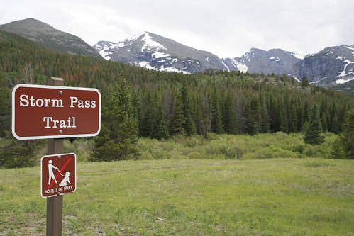
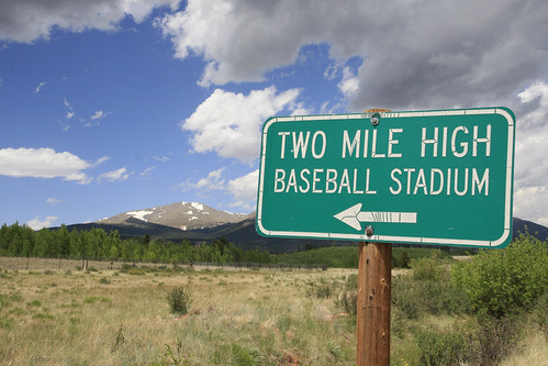
As the storm clouds started to approach, I decided to call it quits and head home to nurse my ankle.  Hopefully I'll be sufficiently healed to climb Longs Peak this weekend.  Longs Peak is the highest mountain in RMNP at 14,255 feet and the 15th highest mountain in Colorado.  Because it's a long hike and thunder storms are attracted to the mountain (usually developing in late morning or early afternoon), we're aiming for a 3:30am trailhead departure.

Tuesday, July 12, 2011

Hiking and Drinking

A long day, an even longer blog post.

Taking the advice of a friendly hiker we met drinking beer on the trail last month (him, not us), we did a loop hike this Saturday, starting at the Storm Pass trailhead in Rocky Mountain National Park.  NO DOGS FOOLS!!!

IMG_1659a by typebangin

What was initially a short loop intended to keep us out of the high country on a potentially stormy day, became more and more ambitious as the day progressed, until we had been hiking for 10 1/2 hours and covered at least 14 or 15 miles.  Before embarking on our journey, we had decided to add a bushwhack up nearby 11,482 foot Half Mountain (at the far left in the above photo) to the loop we had been recommended.  We followed the Boulder Brook Trail for the first 2.5 miles on a pleasant climb devoid of tourists, dogs, horses, and other unpleasant animals sometimes encountered in the wild.  The solitude of the woods was interupted often by the thundering sound of nearby Boulder Brook, which was absolutely slammin' with snowmelt.

IMG_1537a by typebangin

At one point a hummingbird mistook Laura for a giant flower.  After buzzing around her bright pink shirt, it couldn't find a place to extract nectar, and moved on disappointed it hadn't found the world's largest flower (photos of the shirt appear later).  At the junction with the North Longs Peak Trail, we started our bushwhack southwest through the forest.

IMG_1550a by typebangin

Without the aid of my battery deficient GPS, we ended up at Point 12,158 (700 feet higher than Half Mountain), the first of our extra mileage.  After being pummeled by an absolutely ferocious wind on the summit, we made our way north towards Half Mountain.  Despite the clouds and wind, there were no thunderstorms or rain.  Here is a view looking down at Glacier Gorge and Lake Mills from the saddle between the two peaks.

IMG_1579a by typebangin

After a quick snack on Half Mountain, we started the descent down to the North Longs Peak Trail.  Despite the awesome marmot habitat, we saw none; only a few pikas were heard (but not seen) on way down.  Route finding was rather easy without the GPS, and after a very steep descent, we were back on the trail near Glacier Creek.

IMG_1600a by typebangin

Glacier Creek was massively out of control.  It was loud, angry, and definitely not a good place to go for a swim.  At this point, the initial plan had us returning to the Glacier Gorge trailhead and taking the shuttle bus back to our car (as recommended by the aforementioned beer drinking hiker), but Laura suggested a short side trip to see The Loch, 1.5 miles in the opposite direction.  Once there I suggested adding another mile to see Glass Lake and Sky Pond.  Why not?  We hadn't seen any wildlife (hummingbirds, bumble bees, and butterflies don't count), and for a day that was supposed to be stormy, the weather was still very cooperative.

After a mile or so of hiking through the woods, we had to climb a very steep snowbank to gain access to the basin where Glass Lake lies.  It got dangerously steep past the point of this photo, but our perseverance would soon be rewarded when we reached the lake.

IMG_1617a by typebangin

As we were about to leave, I spotted a rather good looking marmot making his way around the lake, no doubt returning home from a visit with his lady friend.  He came all the way around the lake to the outlet, where Icy Brook was racing along.

IMG_1635a by typebangin

He was going to cross the creek!!

IMG_1637a by typebangin

Sizing things up, he hopped from rock to rock with amazing dexterity!!

IMG_1638a by typebangin

Marmots may look like lazy fatties, but they can really move when they have to.

IMG_1640a by typebangin

As he made his way across, it became clear that he was heading straight towards us.

IMG_1643a by typebangin

He darted behind a rock, and then all of a sudden, we were standing face to face.

IMG_1647a by typebangin

We exchanged knowing glances, and then as quickly as he appeared, he was gone.

IMG_1648a by typebangin

While we only saw one marmot that day, we saw one totally awesome, never to be forgotten, marmot.  We decided to abandon the short climb to Sky Pond, as the clouds were threatening and it was getting quite late.  On the way down, we helped an older couple that had slid down the steep snowbank.  I retrieved one of their hiking poles, but the other was in a precarious spot right above a crevasse.  After watching the husband stubbornly retrieve the pole, it started to rain, and we rushed down the trail 4+ miles to the Glacier Gorge trailhead and our shuttle bus ride.

When we noticed that our trailhead was not on the list of bus stops, I started to think, that perhaps, listening to the advice of strangers drinking beer in the woods is not always a wise move.  Then when the bus driver told us he didn't stop there, I really started to question my judgement.  The driver told us the next closest stop was Bierstadt Lake.  How far we asked?  A mile away from the Storm Pass Trailhead.  I decided 2+ miles of trail hiking beat a mile of road walking, so we were off.  The trail paralleling the road was unsurprisingly devoid of people, and we made good time, reaching our car at 6:15pm, 10.5 hours after we had left.

At this point I noticed another parking area a short distance down the road.  Less then 2/10's of a mile away was the Bierstadt Lake trailhead, and a couple of lessons learned: it's OK to trust jovial beer drinking hikers, it's not OK to trust incompetent bus drivers.

Sunday, July 10, 2011

In Search of Moose

I went in search of moose earlier this week, as they are often seen on the west side of RMNP.  Laura had seen them there a couple of weeks ago, and I was determined to see them myself, especially since I've only seen moose once, ever, in my life.*

* OK, Laura blew up my spot; I saw quite a few moose in Alaska, but somehow I managed to forget that trip.  Probably because Alaska is a magical fantasy land and I thought it was all a dream...
Edit: I've seen moose once ever, in the Continental US, in my life.

On my way I decided to stop for a short hike on the Ute Trail, since the wildlife viewing is always good there, and our last trip into the high country didn't yield much.  Booyah!!  Practically as soon as I left my car, I spotted my first marmot on a rock up the hillside.  I was so focused on spotting marmots, I literally walked right past a couple of elk grazing next to the trail.

IMG_1494a by typebangin

I moved past them a bit and took some photographs as they slowly moved through the tundra.

IMG_1497a by typebangin

It seems the elk have mostly left the lower elevations, as I again saw none in the lower meadows and near town, but there were quite a few up on the tundra kickin' it with the marmots.

It didn't take long to find this marmot doin' what marmots do best: straight chillin'.

IMG_1457a by typebangin

Part of the charm of marmots is their relaxed demeanor.  Marmots keep it so real.  Nice sunny day?  No predators around?  Why not find a comfy rock with a view, and get some good relaxing time in?  Marmots just know how to chill better than any other beast I've encountered.  I didn't see any really close marmots as on previous trips, but I sure did observe a lot of maxin' and relaxin'.

IMG_1472a by typebangin

This guy was a little more alert than the last marmot, but I'm sure the minute I left, he rolled on his back and started sipping his beverage of choice.  After "hanging out with the fatties" (as Laura's friend Sharlene dubbed this blog) for awhile, the clouds started to roll in, and I decided it was time to head out to find moose.

After crossing the Continental Divide, I entered the valley on the west side of the park where the moose like to hang out.  Soon I saw what I had been looking for: a beast jam ahead!!!  As I pulled up I was a bit disappointed as it was only a group of elk crossing the road, though two of the males were larger than any I had seen to date.  I got a picture of this smaller guy crossing the road, as the idiot park ranger had already scared the bigger elk away by the time I had the camera ready.

IMG_1521a by typebangin

I drove around some more, but as you can see by the pictures, I saw no moose.  The weather began to worsen, and I headed home still waiting for my first Colorado moose sighting.

Wednesday, July 6, 2011

Indian Peaks - Part 2

On Sunday we went hiking with Laura's labmate Greg and his significant other Ingrid.  The objective this time was Pawnee Pass and hopefully Pawnee Peak.  We ditched the snowshoes for this jaunt, and I brought the beast lens instead.  Despite hiking in the area just the day before, the sheer amount of snow we encountered in the woods was still mindboggling to me.

IMG_1277a by typebangin

While snow conditions were good (snowshoes were not needed), there was substantially more snow on this trail than the one we took the day before.  This was probably because the Pawnee Pass Trail stays at a lower (forested) elevation for longer, as well as being a little closer to the Continental Divide.  While a lot of snow has melted, there are still places where the snow is probably 10 feet deep in the woods.  Here is a comparison of the trailhead in February and July:

IMG_4619 by typebangin

IMG_1404a by typebangin

One more comparison showing how much snow has melted:

IMG_4646 by typebangin

IMG_1402a by typebangin

While it's amazing how much snow was on the ground back in February, it's even more amazing how much still remains further up the trail.  Here Laura crosses a bridge that has been totally submerged by snow melt.  At first, I didn't even realize there was a bridge here!!

IMG_1399a by typebangin

Shortly into the hike, our feet were soaked, and would remain soaked for the rest of the day.  After losing the trail frequently in the first few miles and being greatly slowed by the massive amounts of snow, we were greeted by this ridiculous waterfall above Long Lake:

IMG_1296a by typebangin

Words (and pictures) cannot describe this insane waterfall.  Raging melt water had punctured a hole in this giant snowbank, but then somehow retreated behind the snow and disappeared.  It didn't even look real when we were there.  If it weren't for the roar of the raging water, you'd swear it was an optical illusion.  I'm certain I'll ever see a waterfall this awesome again; I don't know how you could possibly top it.  Perhaps if a kayaker came shooting out of it, or something equally preposterous happened.  But even that probably wouldn't seem odd, since the waterfall already seemed to defy all physical laws.  A closer view:

IMG_1298a by typebangin

After soaking it in, we climbed around the waterfall and discovered its source: Lake Isabelle.

IMG_1304a by typebangin

At this point the trail was completely obscured by snow, so we again just climbed towards our destination.

IMG_1319a by typebangin

My thoughts of glissading were soon interrupted by this feathery fellow.  A Ptarmigan!!!

IMG_1313a by typebangin

The birds have shed their winter coats, and blend in pretty well with the rocks now.  They are easily approached and I was able to snap some good shots thanks to the aforementioned beast lens.  In the first photo you can see their unusual feathery feet and legs.

IMG_1372a by typebangin

IMG_1381a by typebangin

At this point, I still hadn't seen a single marmot, and wouldn't the rest of the day.  I got a few brief glimpses of pikas, but nothing else.  Thankfully the ptarmigan was a nice change of pace and also a willing photographic subject.

After reaching the pass and summiting Pawnee Peak we turned back quickly as there were threatening clouds to the west.  We skipped a few good glissades that may have been overly steep (according to someone else...).  I wasn't going to pass up an opportunity at the next major snowfield though!

IMG_1353a by typebangin

After the first glissade, prior skepticism vanished and glissade mania set in; everyone was having an awesome time.  We hiked up one snowfield two extra times, just so we could glissade down again.  Despite miserably wet feet, all discomfort was forgotten.  Here Laura races down the second slope:

IMG_1391a by typebangin

We reached the flat part of the trail way to soon and some sadness set in, knowing our fun was over.  Despite the general lack of wildlife, it turned out to be an epic adventure, as the glissading was once again the highlight of the day.  Next winter is going to be crazy!!!

Tuesday, July 5, 2011

Indian Peaks - Part 1

This weekend, Laura and I spent two days hiking in the Indian Peaks Wilderness which is very close to where we live.  On Saturday, we set out to climb Mt Audubon, one of the easier summits in the area.

IMG_1272a by typebangin

I never tire of seeing marmots, as they are one of the most awesome mountains beasts.  Very soon after breaking out of the trees, we spotted our first marmot.

IMG_1181a by typebangin

This guy was checking out the view of Mitchell Lake below.  Since we were carrying our snowshoes, I had decided to leave my better beast lens at home to save weight.  Big mistake, as the marmots were abundant.  Here is a view of Mitchell Lake without a distant marmot:

IMG_1183a by typebangin

Because of the snow, we lost the trail, and ended up hiking up the side of the mountain, until we reconnected with the trail in a marmot filled meadow.  While these wilderness marmots were not as skittish as the plain old National Forest variety, they were not nearly as friendly and photogenic as the National Park dwellers.  While eating lunch at the top of the mountain, a marmot walked right by us.  Stupidly, I left my camera on a distant rock, and by the time I recovered it, the marmot had escaped.  Here we are at the top, shortly before the marmot strolled by:

IMG_1224a by typebangin

But all was not lost.  On the way up we had witnessed the most awesome of snow activities: glissading!!!  We watched as two mountaineers took the quick way down below the summit.  When we passed them on the trail a little while later, they informed us that they didn't need their ice axes for this particular glissade.  Perfect, because we don't own ice axes.  After lunch we set off for the snowfield and a new adventure.  Laura was typically cautious, but I couldn't control my excitement.  Unfortunately I listened to Laura and put my camera away during the actual glissade, but I still got pictures of her racing down after I was done.

IMG_1237a by typebangin

For those who are unfamiliar with glissading, it's kind of like sledding, except instead of using a sled, you just use your ass!  And instead of going down a 'hill' you go down a mountain!!  While your buttocks don't always appreciate being frozen numb, hitting bumps, and being damp for quite awhile afterwards, it is without a doubt, the most fun you'll have in the snow, especially since it's your reward for climbing a mountain.  I'm pretty much over downhill skiing, cross-country skiing, snowshoeing, and sledding now that I've discovered glissading.

We passed quite a few marmots on the way back down, and never needed the snowshoes as the snow was well packed on the trail.  Despite missing out on some good marmot shots thanks to my bad gear decision, it was an awesome day, and there would be more opportunities tomorrow....

Friday, July 1, 2011

High School Reunion

This past weekend we attended Laura's ten year high school reunion.  Sadly, I took no pictures at this momentous event.  While I knew full well there would be no awesome beast sightings, I brought my camera anyway, so I could take pictures for Laura if she desired.  She didn't.  Being the unemployed vagabond I currently am, I went to Laura's parents house early to take pictures, watch trains, go hiking, and explore the world, before being subjected to the very highly anticipated reunion.

Snow melt is in full effect in the mountains, and all the creeks and rivers are raging.  Here are two views of the Animas River in the Weminuche Wilderness of Southern Colorado:

IMG_0799a by typebangin

IMG_0807a by typebangin

You do not want to swim in this river!!  I did see some guys kayaking, but they are probably not alive anymore.

On the second day there, I was greeted by this friendly looking roadside marmot:

IMG_0557a by typebangin

Unfortunately, he was well aware that he was in a National Forest and not a National Park.  I only got this one quick photo, before he ran away from me.  Total marmot count for the week: 3.  Total marmot photo count for the week: 1 (slightly out of focus).  Someone needs to import the National Park marmots to this area of the state.  Perhaps some scientist could write a grant for this important work...

Later that day, I was warned about some dangerous animals that could be potentially blocking the road.

IMG_0991a by typebangin

I believe this sign may have been mistakenly placed in this location.  It's not Hadley MA, where dairy cows roam the roads with impunity.

Later that week, we were once again warned of a potentially dangerous obstacle.

IMG_1083a by typebangin

While not as awesome as an actual big horn sheep; how often do you see signs for them?  Not to mention firetrucks, because they usually share the same habitat.

The most awesome spotting occurred on Saturday.  Instead of attending the combo tour of the new high school / low rider car show (I wish I could make up stuff this good), we went hiking with Laura's parents in mountains north of Durango CO.  Less than a quarter of a mile up the trail, we heard a very distressing yelp, unlike any noise I've ever heard, looked up, and saw this tiny critter on the embankment above the trail:

IMG_1016a by typebangin

At first I thought it was a baby deer, as it was very small, but Laura's dad was quite certain that it was an elk.  I couldn't believe this, as we had just seen a baby elk the week before, and it was much larger than this guy.  Well, this was not just a baby elk, it was a newborn baby elk.  Possibly earlier that morning, and at most, a couple of days old!!!

It looked around:

IMG_1017a by typebangin

And then came tumbling pitifully down the embankment.  It didn't even move after it came to a stop, lying right on the trail.

IMG_1019a by typebangin

We took a few quick photos and hustled along; you do not want to antagonize a mama elk, unless you think having a ruptured spleen is a good thing.  The mother was nowhere to be seen, but we weren't taking any chances.  Later, when we came back down the trail, the baby elk was gone.  Hopefully the mother came and gave it some yummy elk milk, and they moseyed on.  Or maybe a bear had a tasty lunch.  Either way something good happened...

Feel free to stop reading at this point, as I probably won't top this for awhile, and it's definitely the pinnacle of this particular tale.  I really hope to see baby marmots (super hard), or maybe bear cubs (really super hard).  But since I haven't seen a single bear yet, seeing bear cubs is probably a bit of a stretch.

The next day, Laura and had planned to climb Centennial Peak and maybe Sharkstooth in the La Plata Mountains.  Unfortunately I didn't have trail mileages, and was a little optimistic with my map interpretation.  After about five and a half miles of hiking and crossing two passes, we got to a view of our objective and realized we still had at least 3 miles to go, and had to drop into a significant valley we would then have to climb steeply out of.  At this point it was going to be an 18-20 mile round-trip hike and we realized it was time to abandon our original plan.  We then climbed into this high meadow with dainty wildflowers and great views of the surrounding mountains, including Sharkstooth.

IMG_1053a by typebangin

We did see a marmot and a few pikas, so all was not lost.  Here is the view in the opposite direction:

IMG_1060a by typebangin

We had climbed via Kennebec pass, visible in the distance in the far left corner of the photo.  We also saw one mule deer on our way back.  It was next to our car at the trailhead.

Finally on our way home, we passed the new Unnatural Selection softball training facility:

IMG_1080a by typebangin

Tomorrow we climb Mt Audubon and hopefully more awesome beast sightings will occur.  Unfortunately we'll be in the Indian Peaks Wilderness and not the National Park, so the beasts may not be familiar with proper posing and behavior.  I'll let you know how it goes.