Saturday, August 20, 2011

Grays Peak / Torreys Peak

The morning after my hike to Rollins Pass, I woke up at 3:30am with an aching knee.  Hopefully it wouldn't be too bad, as Laura and I planned to climb two 14ers on our way to camp with her parents in southern Colorado.  We left Boulder at 4:00 in the morning and drove west on I-70 towards the Continental Divide and the Grays Peak trailhead.

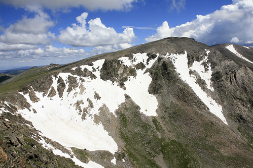
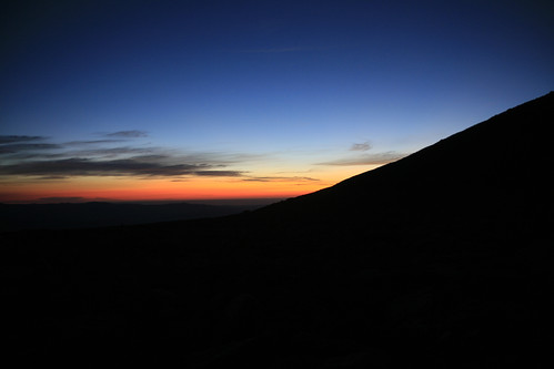
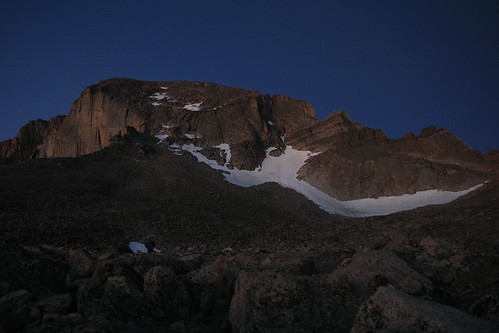
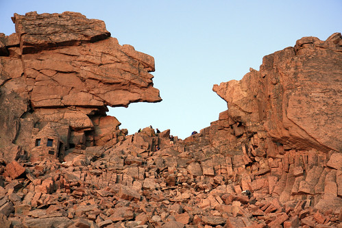
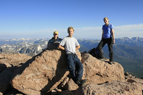
Everything was going well until we got stuck halfway up the steep dirt road to the trailhead at 5:30 in the morning, in the dark...!  Did I mention there were 5 cars behind us (this is apparently a very popular hike) that precluded us from just rolling back to a wide spot in the road?!  After a tense few minutes and some much needed help, we left the car at a good spot, and began walking up the road.  Thankfully my knee felt better the further I walked.  After 1.5 miles and quite a few 4WD's and Subaru's passing us, we reached the trailhead as the sun was rising.  Soon after, we were greeted by this view of Grays (left) and Torreys (right).

IMG_2626a by typebangin

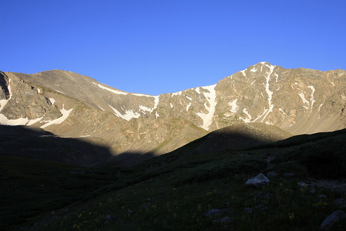
With less than a mile separating them, you can see why people climb both mountains at the same time.  This would be our highest elevation attained to date: Grays is 14,270 and Torreys is a few feet shorter at 14,267 (even though it appears taller and more impressive from this viewpoint).  Grays also has the distinction of being the highest peak situated on the Continental Divide.

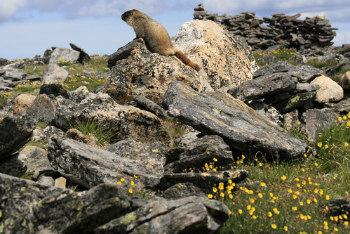
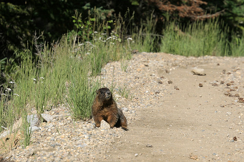
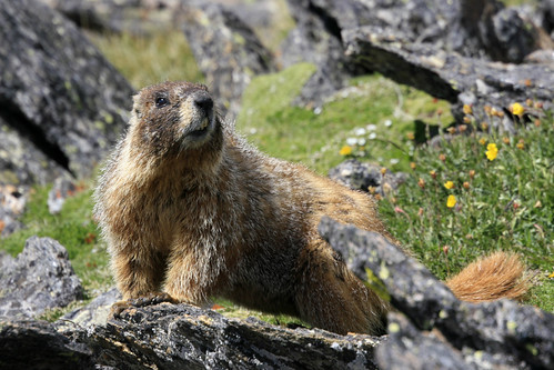
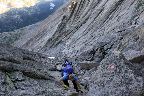
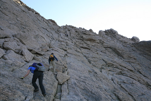
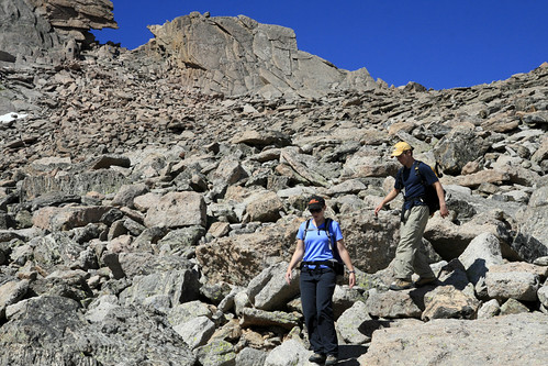
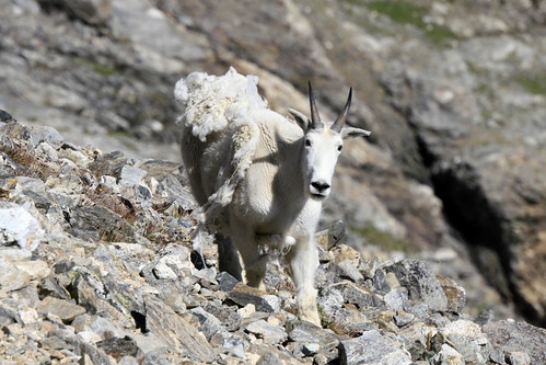
We began to ascend the steep ridge of Grays Peak about an hour after we left the trailhead.  A group of hikers coming down from a sunrise climb informed us there was a mountain goat ahead.  Excited, we came around a bend and met this guy happily munching some grass:

IMG_2653a by typebangin

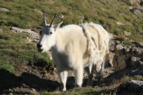
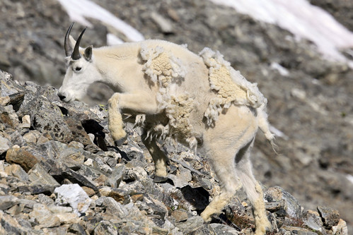
He was not at all frightened by us, and I had to wait a few minutes while he chomped on his breakfast before I was able to get any good pictures.  We had never seen a mountain goat before, and had done this hike, in part, because this area is well known for seeing them.  He still had some of his winter coat, and was looking quite "shaggedy."  Content with our first goat sighting, we were very surprised to see at least half a dozen more a short while later. 

IMG_2672a by typebangin

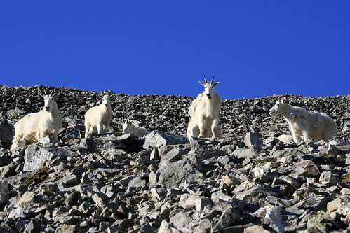
There was at least one kid (that's really what you call a baby goat) amongst what were probably all nannies (female goats).  And yes, males are known as billies.  We were both quite enthralled with the goats, though a more experienced mountaineer we met found them much less appealing, especially when they poke their heads in his tent in the middle of the night!!  I told him I would be quite pleased to experience that at least once!

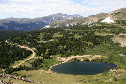
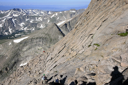
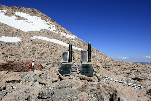
We made good time up Grays Peak; even with the extra road walking, we passed many people on foot that had passed us in their cars.  Here is a view near the summit looking down the valley we had just climbed up from:

IMG_2685a by typebangin

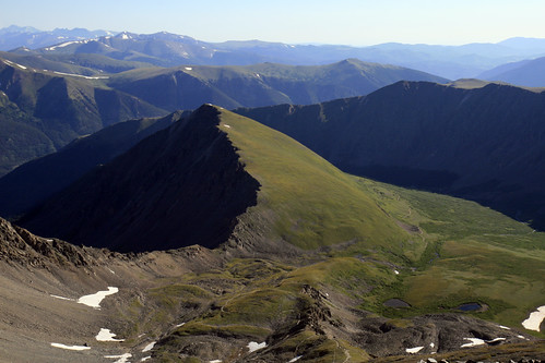
There was shade in the valleys for a long time, as they were narrow and the high mountains blocked the sun until late morning.  Once on top, some other hikers informed us of a promotion to get a free sandwich at a local sub shop.  If you bring in a photo of yourself on top of 14er holding their sandwich bag, you get a free sub!!!  This was almost as good as seeing goats!!!

IMG_2690a by typebangin

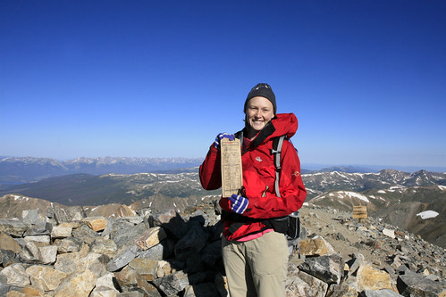
Needless to say, we took a lot of photos.  Hopefully I'll be eating free subs for awhile!!

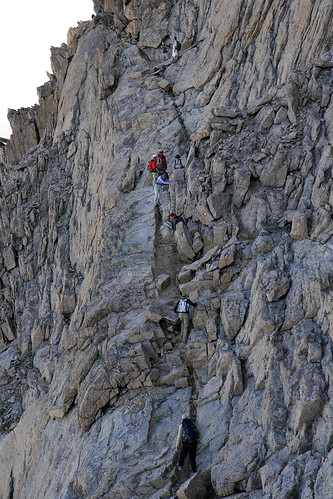
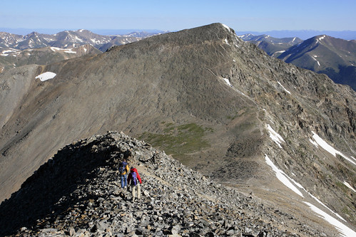
After a short break, we headed down towards the saddle and our next 14er.

IMG_2695a by typebangin

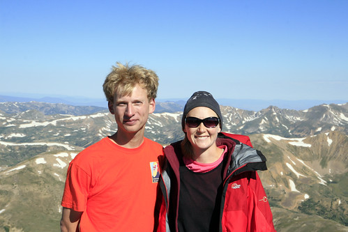
Once atop Torreys Peak, we took more photos, including a few without the sub bag.  I was very excited to wear my new 2011 Unnatural Selection softball shirt that our friend Anna had sent us from Massachusetts.  I had gotten it earlier in the week, and had to wait a few excruciating days before I could break it in at 14,000 feet.  I tried hard to wear it the rest of the weekend, though Laura finally won out on Sunday morning.

IMG_2701a by typebangin

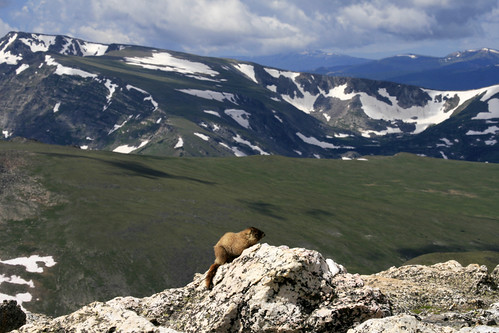
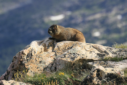
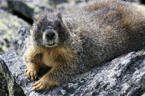
On the way down we saw a couple of billy goats right next to the trail.

IMG_2721a by typebangin

It's really amazing watching them climb.  I was also surprised at how little vegetation there was at the higher elevations they were feeding at.

IMG_2730a by typebangin

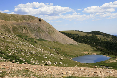
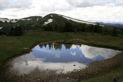
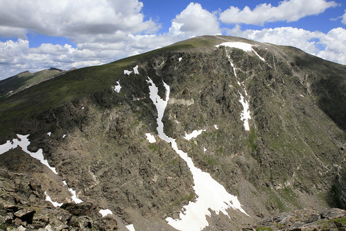
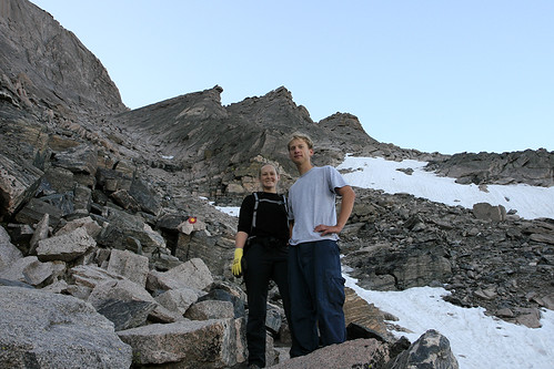
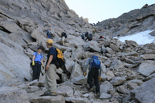
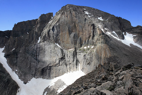
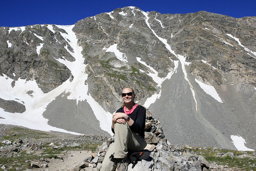
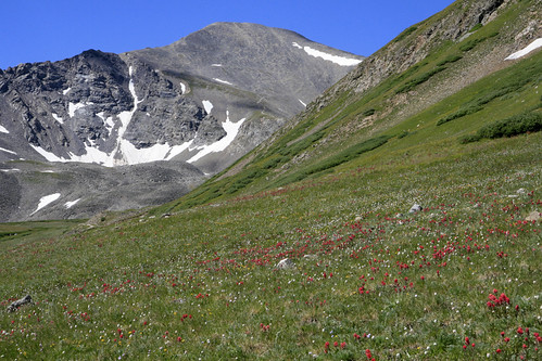
We passed tons of people on the way back down.  Though this combo hike is easier than Longs Peak, thankfully there weren't quite as many people (though the crowds were pretty substantial for a Friday morning).  This is one of the problems with climbing 14ers.  There are a lot of people that want to climb them and the easiest ones have good trails and heavy usage.  We should get more solitude (and difficulty) tomorrow on our sub-14,000 foot Mummy Mania traverse.  Halfway down, we stopped for a break at this nice view of Torreys Peak:

IMG_2786a by typebangin

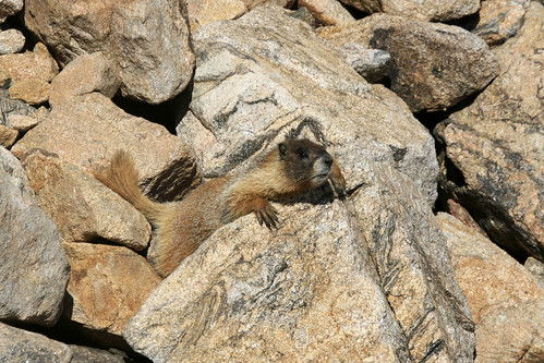
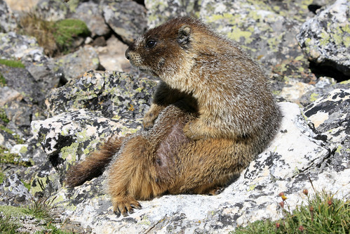
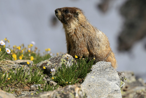
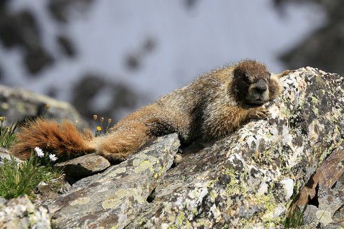
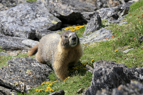
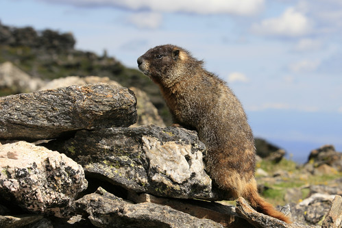
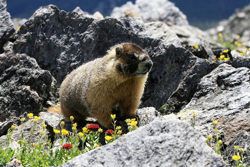
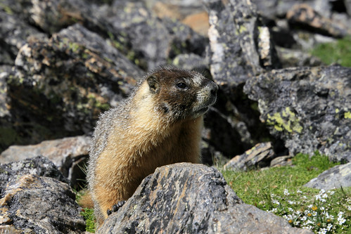
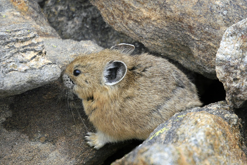
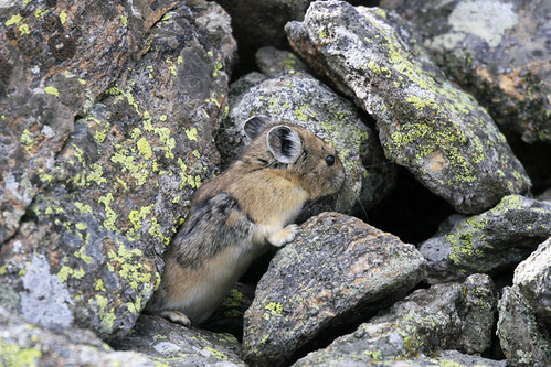
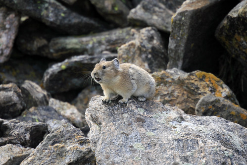
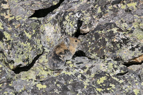
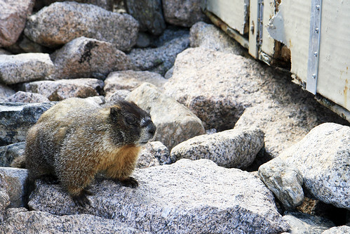
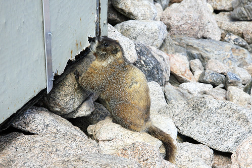
There were a lot of pikas on the lower sections of the trail and we watched them for quite a bit.

IMG_2765a by typebangin

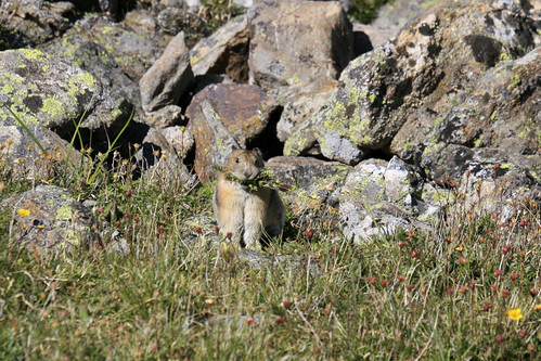
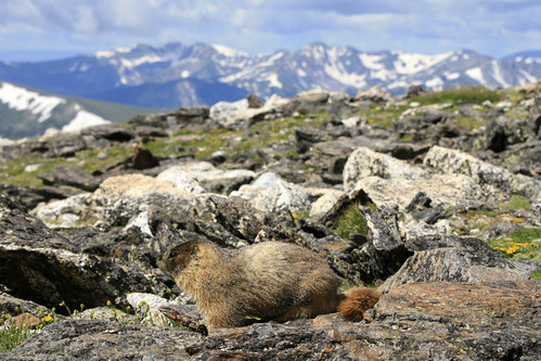
Laura had good eyes, and spotted this guy gathering hay.  Further down the wildflowers were really spectacular.  Here is the last view of Grays Peak before it disappeared out of view:

IMG_2802a by typebangin

After an uneventful walk back to our car, we headed towards the Interstate and a 4+ hour drive to South Fork and a rendezvous with Laura's parents.

Thursday, August 18, 2011

Rollins Pass

Ever since we moved to Colorado and I began reading about Rollins Pass, I've wanted to hike up and explore the surrounding area.  Rollins Pass, a natural low point on the Continental Divide, was named after John Rollins who built a toll wagon road over the pass in the 1870's.  By 1904, the Denver, Northwestern and Pacific Railway had laid rails over the 11,660 foot high pass, making it (I believe) the highest standard gauge railroad in the US.  In 1928 the Moffat Tunnel opened, effectively closing Rollins Pass.  On the east side of the pass, the old railroad grade is now a 4WD road as far as Needles Eye Tunnel where it has been blocked off and permanently closed.  Last Thursday I drove to the east portal of the 6.2 mile long Moffat Tunnel, and hiked into the James Peak Wilderness bound for Rollins Pass.

IMG_2480a by typebangin

A four mile hike through the woods on the Forest Lakes Trail would bring me to the 4WD road, just below treeline.  It was a perfect morning when I reached the first lake, as the Continental Divide was reflected in the calm waters.  As I got close to the bank a trout darted away, startled by my approach and in fear (I'm sure) of my fishing prowess.

IMG_2486a by typebangin

A little further up the trail and closer to the mountains, I passed the second Forest Lake.

IMG_2491a by typebangin

Soon afterwards, I passed the wilderness boundary and the trail ended at the old railroad grade.  Luckily a short distance later, a large snowdrift was still blocking the road, so no ATV's or 4x4's could pass.  I had a great view of Needles Eye Tunnel and Jenny Lake as I followed the old railroad grade up the mountainside.

IMG_2615a by typebangin

As I got above treeline, I saw the first of many skittish marmots living near the old roadbed.  This guy was making sure I wasn't really hunting him:

IMG_2532a by typebangin

As I walked along I heard many "whistle pigs" (as marmots are sometimes called) alerting others to my presence.  Quite a few darted across the roadbed in front of me and into the safety of their dens.  While walking through a rock cut, an unseen marmot whistled at me, causing me great fright as the shrill call echoed off the rocks and left quite a ringing in my ears.

I finally reached Needles Eye Tunnel and climbed above it.  Here is the view from the tunnel, looking down at Jenny Lake, the old railroad grade, and James Peak in the far distance:

IMG_2547a by typebangin

Past the tunnel, you can keep following the old railroad grade to the abandoned Devils Slide Trestles.  Many years ago, you could still drive a car through the tunnel and across these bridges.

IMG_2580a by typebangin

I finally reached Rollins Pass, also known as Corona Pass (Spanish for crown), a short while later.  Apparently the small settlement that once existed on top was known as Corona because it was supposedly the "crown of the world."  I took a shorter route back, cutting across the mountain instead of following the winding road.  While considerably shorter in mileage, it was of course, more strenuous.  After 14 or 15 miles of hiking, I got back to the car exhausted and headed home to Boulder.  Once I got back, I couldn't find the sandwich I was so looking forward to in the fridge; I later learned Laura had eaten it after I left.  D'oh!!!

Sunday, August 14, 2011

Fall River Road - Part 2

Though the clouds were beginning to build up, it was still a beautiful sunny day on the summit of Mt. Chiquita.  I had a much needed snack and water break while contemplating my next move.  As I finished eating, I noticed a handsome marmot perched nearby.

IMG_2303a by typebangin

As I made my way towards this majestic fatty, I almost stepped on a closer marmot I hadn't even noticed.

IMG_2282a by typebangin

Scanning the ground around me, I saw 5 marmots within a 10 foot radius!!!  And they all seemed to be quite friendly; none of them were the least bit concerned with my presence.

As I made my way around the gentle summit of Mt. Chiquita, it became quite clear that there were a lot of marmots up here.

IMG_2308a by typebangin

Mt. Ypsilon would have to wait; there were a lot of photos to take.

This guy was doing some serious relaxin':

IMG_2312a by typebangin

At one point this marmot walked right up to me:

IMG_2319a by typebangin

He got within about a foot of me, and after I scared him away briefly, he returned for a second visit.

IMG_2327a by typebangin

I easily saw more marmots on this one summit than I'd ever seen in an entire day of hiking.  I literally took hundreds of photos, and even after editing them down, I considered titling this post "100 Photos of Marmots."

IMG_2338a by typebangin

Eventually I decided I needed to head back, since I still wanted to climb Mt. Chapin and hopefully see some more pikas.  Even this proved difficult, as I kept passing marmots, and as long as the light was good, I wanted to keep shooting.

IMG_2348a by typebangin

On the way down I saw six marmots at once, though they were within a slightly larger radius than the earlier five (within ten feet).

IMG_2351a by typebangin

This marmot was enjoying the magnificent vistas of the Colorado Rockies:

IMG_2358a by typebangin

Despite being a shorter and easier climb, there was no one on Mt. Chapin.  I passed a number of people on the trail to Chiquita, most likely enthralled with its 13er status (Chapin is not as tall), and perhaps just following the more obvious trail as I had.  Chapin provided a surprising bit of solitude and, as hoped, more pikas!!

IMG_2403a by typebangin

Clouds filled the sky as I descended from Mt. Chapin, and I wouldn't see the sun for the rest of the hike.  After passing the guard marmot at treeline again, I made a side trip to photograph this tarn as the storms moved in:

IMG_2426a by typebangin

After a few photos, I hustled down the trail to my car, as the thunder was rumbling in the distance.  Back to Boulder and a rendezvous with Darrell (our farmer) for some organic veggies; another day, another adventure.

Monday, August 8, 2011

Fall River Road - Part 1

Fall River Road was the original road through RMNP, linking Estes Park on the east side of the park with Grand Lake on the west.  It was replaced by Trail Ridge Road in 1932, and is now a one-way single-lane dirt road that climbs west from Sheep Lakes to the Alpine Visitor Center, where it reconnects with the paved Trail Ridge Road.  It had just opened for the (quite short) season when I drove it this past Wednesday.  My first stop was Chasm Falls, which is conveniently located right off the road.

IMG_2143a by typebangin

Further up the road, I evaded this furry toll collector with some deft street-racing moves in Laura's '95 Geo Prizm.

IMG_2174a by typebangin

At Chapin Pass, I decided to embark on an impromptu hike up to the tundra, which, quickly evolved into a climb of Mt. Chapin and Mt. Chiquita.  At a switchback in the trail, I met this marmot standing guard near treeline.

IMG_2176a by typebangin

To my surprise, the upper slopes of Mt. Chapin were full of pikas!!

IMG_2187a by typebangin

For those who don't know, pikas are lagomorphs; they are most closely related to rabbits and hares, which constitute the other family (Leporidae) within the order Lagomorpha.  They are not rodents.  Pikas live above treeline in boulder fields and talus slopes near suitable vegetation for feeding.  Since they do not hibernate, they must harvest grasses and flowers which, they then dry and store as hay for the winter months.

IMG_2194a by typebangin

After approaching this pika, he sounded the alarm: a distinctive high pitched sound that marmots also listen for to help warn them of danger.  The next pika I saw (below) was very well camouflaged.

IMG_2203a by typebangin

This was definitely the best pika viewing since we moved to Colorado.  I've had a hard time shooting them, as they are small and fast, and unlike marmots, they don't seem to like posing much.  Today was much better; I even saw one transporting a big wad of grass and flowers in its mouth, but unfortunately, I was unable to get a picture.

I decided to climb the higher and further Mt. Chiquita first, as I didn't see a good trail leading up to the summit of Chapin, plus the path I was on was leading me in that direction anyway.  Here is a view of Chiquita from the south:

IMG_2385a by typebangin

At 13,069 feet, Chiquita is the shortest 13er in the park, and also the easiest to climb (via the Chapin Pass route I was on).  It's only a little over 2,000 feet of elevation gain and about 3 miles to the summit.  As I climbed the more gentle west side of the mountain, the abundant pikas began to disappear, replaced by their high mountain brethern: marmots!!

IMG_2255a by typebangin

This guy was straight chillin' near the summit:

IMG_2267a by typebangin

Once at the summit, Mt. Ypsilon looked tantalizingly close.  This is part of the route we hope to hike in a couple of weeks called "Mummy Mania" or "Mummy Kill."  It's a one way traverse which involves 6 (or more) summits in the Mummy Range.

IMG_2277a by typebangin

I had already made good time up Chiquita, and Ypsilon (at 13,514 feet) didn't seem that far away.  What could possibly stop me from adding another summit to this totally unplanned hike...?

Monday, August 1, 2011

Longs Peak

We left Boulder a little after 1:45am on Sunday so we could climb Longs Peak.  At 14,255 feet, it's the northernmost 14er in the Rocky Mountains, the highest peak in Rocky Mountain National Park, and the 15th highest peak in Colorado.  For comparison, the highest peak in Colorado is Mt. Elbert at 14,433 feet, and the highest in the Continental US is Mt. Whitney in California at 14,505.  Because of its stature, location in a National Park, and proximity to Denver, Longs is one of the most frequently attempted high peaks.  We literally saw a few hundred people (mostly on the return) attempting the climb, and a quick glance at the trail register afterwards seemed to validate our estimate.

After meeting up with our friend Aaron, we started hiking at 3am, which is considered the standard starting time for the Keyhole Route.  It's recommended to start this hike anytime between 1:00 and 5:00am.  Because Longs Peak is substantially higher than the surrounding mountains, it regularly attracts foul weather.  By leaving so early, you minimize your chances of being caught in the quite common afternoon thunderstorms that make the exposed upper sections very treacherous when wet (not to mention avoiding the very real threat of lightning strikes).  It's over 15 miles roundtrip, with at least 3 hours or so spent past the Keyhole: not the place you want to be caught in a storm.

IMG_1963a by typebangin

As our level of fitness was substantially higher than a lot of those attempting the hike, we passed at least a dozen people by the time we got to the awesomely named Goblins Forest.  Once we got above treeline, you could see the glow of headlamps for miles ahead, as people snaked their way up the mountain.  Sometime after 4:00am Laura spotted a herd of elk in a high meadow as we passed near them.  While they were very difficult to see, it was an incredible feeling to be out so early, and in the company of wildlife.  We passed many more people on our way to the Boulderfield: quite a few who were struggling mightily and had probably never been hiking before, nor been acclimated to high altitude.

We reached the Boulderfield at 5:30am. There was a warm vibrant glow beginning to appear on the horizon: the sun would soon be up.  The shoulder of Mt. Lady Washington blocks the full view of the horizon below:

IMG_1964a by typebangin

Longs Peak was glowing as the early morning light illuminated its east face.  It was becoming much easier to see, just as the climb was about to get more difficult.

IMG_1966a by typebangin

As we approached the Keyhole, we were greeted by the first rays of sunshine.  Once through the Keyhole, the route follows along the west side of Longs Peak on the Ledges, an exposed section of broken ledges above steep rock slabs.  We would be in shade the rest of the way to the summit, as the mountain blocks the sun here until the afternoon.

IMG_1971a by typebangin

At this point the route is marked by 'bulls-eyes' painted on the rock, as the best route is not always obvious.  While Longs is rated as one of the more difficult Class 3 14ers, it's still far easier than many mountains where there is no established or marked route.  At the end of the Ledges, you enter the Trough.

IMG_1989a by typebangin

Laura and I are at the beginning of the Trough above.  After climbing over 700 vertical feet up the Trough, you reach the crux: the hardest Class 3 hiking on the route.  Hikes are graded on a scale of 1-5 with 1 being hiking on a trail and 5 being technical rock-climbing (with decimal points added above 5 to denote difficulty).  Class 3 is generally climbing where you need to use both your hands and legs.  You could use a rope (we passed two people on a guided climb that were roped up), but it isn't necessary.  Longs Peaks is rated as Class 3+ by some.  All of us agreed that the hike was easier than we thought it would be; it seems they try to scare the less experienced people (rightfully so) that shouldn't be climbing.  On average, 2 people die each year on Longs Peak, usually due to falls.  Here Laura scrambles up the crux:

IMG_2001a by typebangin

After exiting the Trough, you traverse the Narrows, a narrow exposed ledge with a 1000+ foot sheer drop on your right.  As the Narrows open up you enter the Homestretch, the last scrambling to the summit: roughly 400 more vertical feet.

IMG_2014a by typebangin

We reached the summit at 7:30am, long before most people, and before it was crowded.

IMG_2034a by typebangin

After some exploring on the relatively flat, boulder-filled summit, and a strange early morning "lunch," we began our journey back down at around 8:30am.

IMG_2046a by typebangin

On our way back down the Homestretch (above), we had to constantly navigate the throngs of people climbing up towards the summit.  Here is a view of the Narrows on the way back:

IMG_2051a by typebangin

The crowds really intensified once we we got back to the Trough, as there were quite a lot of people unsure of how to execute the crux move.

IMG_2065a by typebangin

We got back to the Keyhole around 9:45, and set our sights on Mt. Lady Washington.  After abandoning our climb last time because of stormy weather, we were determined to tack on some extra elevation and difficulty to this hike.  Thankfully for us (and all the people still approaching Longs in the Boulderfield), there wasn't a cloud in the sky.

IMG_2077a by typebangin

We dropped down from the Keyhole, and made our way to the outhouses in the Boulderfield.

IMG_2079a by typebangin

Now you may be wondering: why am I looking at a picture of outhouses?  Well, these are not your ordinary outhouses.  Because they aren't in the ground!!!  You walk up a few steps to get in.  Once inside, the wall only comes up to your chest, and there is no roof!!!  Most definitely the best view I've ever had from a toilet.  We think the waste must be transported out, as they are not permanent, and therefore I imagine, have no lasting effect on the area.  Out of my abundant kindness, I'll spare you the photos of people in the outhouse.

Now, there is one other interesting thing about these outhouses.  A bad-ass marmot lives here!!!

IMG_2094a by typebangin

But, not only does this marmot seem to reside underneath the outhouses, he happily eats his residence!!  He was not at all shy about munching on the outer walls.

IMG_2109a by typebangin

Either the wood is quite tasty, or this marmot has a vendetta against the National Park Service.  I'm rooting for him either way!  After exhausting the patience of my companions with my marmot watching, we set out to finally climb Mt. Lady Washington, which is on the east side of the Boulderfield.

IMG_2122a by typebangin

This is a view of Longs Peak from the summit of Mt. Lady Washington, almost a thousand feet below the summit of Longs.  You can see why you must encircle most of Longs Peak in order to climb it.  The east face is 2,000 feet of sheer rock known as the Diamond.  It can be climbed, but only as a technical rock-climbing route.

After another early lunch (it was only a little after 11am), we started the long descent down to Chasm Junction and a very appreciated (by our legs) return to maintained trail.  We reached the Longs Peak trailhead just before 2pm after a mostly uneventful trip back.  It's not everyday that you want eat to dinner and go to bed at 2 in the afternoon.

IMG_2138a by typebangin