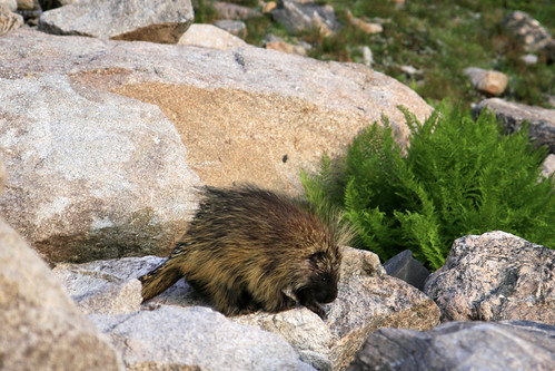
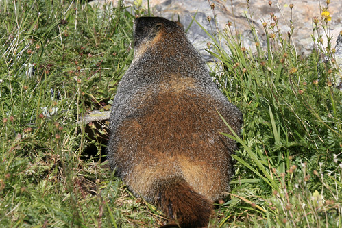
A little past the lake Laura spotted what, at first glance, looked like a very fat marmot. She quickly realized it was a porcupine!!
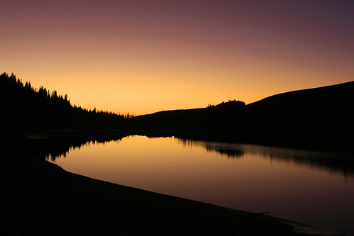
After watching him briefly, we headed further up the trail and were greeted by this reflection of Shoshoni Peak. There was frost all over, as summer has very quickly turned to fall here in the mountains.
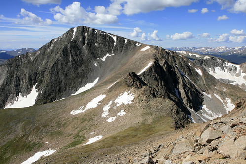
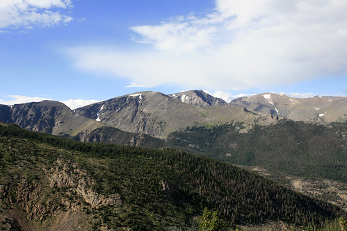
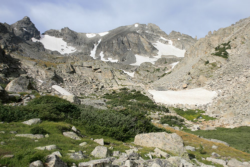
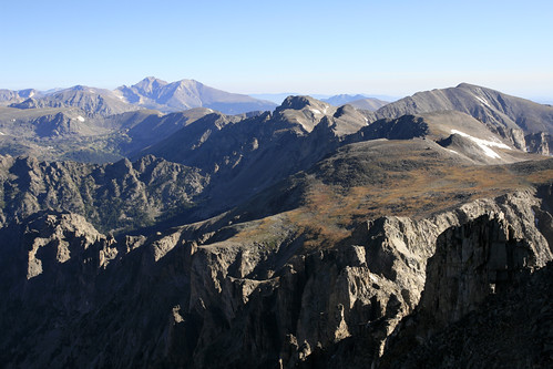
After a little more hiking, we came to a good view of our primary objectives: Apache on the right, and the much more rugged Navajo on the left:
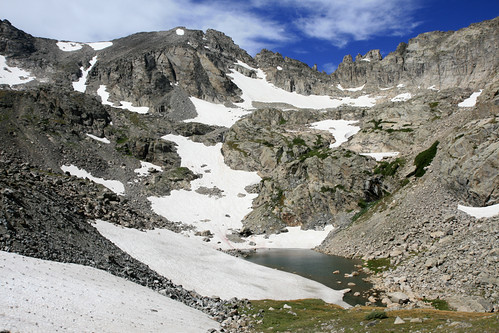
At 11,400 feet we reached a small unnamed lake. Here we would leave the Isabelle Glacier Trail, cross the snowfield above the lake, and begin a steep climb to the basin below Navajo Snowfield.
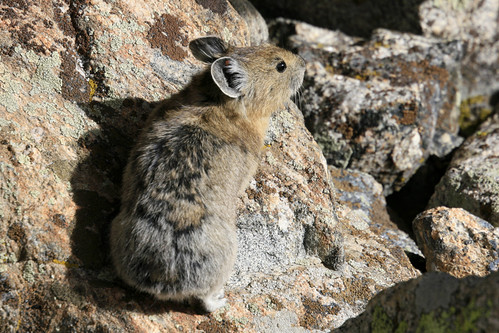
Pikas were abundant in this area. Note how well the patterning on this pika's fur matches the surrounding rocks.
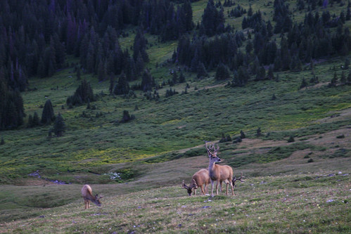
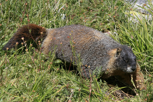
A little further up we saw some very fat marmots. Summer is almost over, and they've been packing on the pounds in anticipation of a long winter in hibernation.
At one point, a big fatty zoomed right towards me in (what turned out to be) a race for the safety of his burrow (mere feet from where I was standing). It happened so quickly, I couldn't get a single picture!
While resting near Navajo Snowfield, we met a couple of fake-ass mountaineers that we had passed a little earlier. They were going to do Apache and then Navajo's North Face - a technical rock climbing route. They had rope, helmets, and axes. After they passed us, we leapfrogged them one more time, at which point they informed us they were going to bail on Apache - more than 1,000 ft below the summit - a little after 8:00am - on a perfectly clear morning - with a favorable forecast!! It seemed an odd decision (at an odd time), especially since they were going to end up only a few hundred feet below Apache on their route to Navajo.
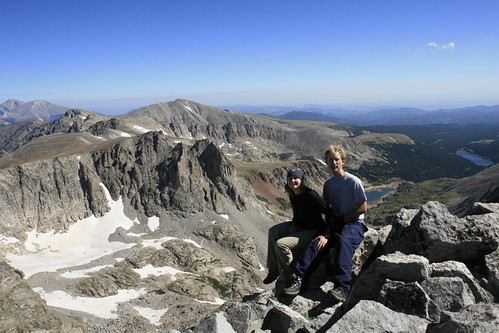
I had been hoping we could follow them up Apache's Class 3 East Ledges route, since they looked like they knew what they were doing, and the climb required some route-finding to keep the difficulty to a minimum. Oh well... It wasn't meant to be. We left them and proceeded up some loose scree, attained the ledges, and hopped up talus to the summit without too much difficulty. It was only 9 o'clock in the morning, and there wasn't a cloud in the sky.
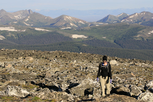
The view from Apache was incredible. We could see Longs Peak in the distance (to the left), and Pawnee Peak and Mt. Audubon closer (to the right) - all mountains we had climbed earlier this summer. At this point Laura tried to recount all the high peaks we had climbed so far this year, coming up with an unverified tally of 18. After a quick snack, we were off towards Navajo.
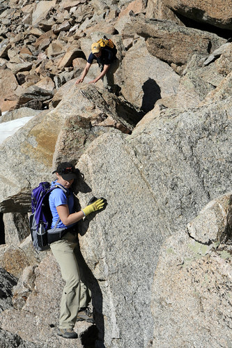
The south ridge was easy going until we got near the comically named Dicker's Peck. Just above the towering pinnacle, we ran into the aforementioned mountaineers again. Now they informed us that they were going to bail on Navajo!! In their alternate universe the East Ledges were really difficult and the mountain was nothing but loose rotten rock. At this point it became obvious that their wealth of gear could in no way compensate for their lack of experience. We were perched above a steep gully that led down to the base of Dicker's Peck, and it didn't look promising. After a quick consultation of our Gerry Roach guide (which they also had - but seemed incapable of following), I found the relatively easy Class 3 route down. Despite some skepticism, they slowly followed us down to the base of the pinnacle.
We left them for good at this point. After passing the 'Peck,' we scrambled up to a ledge that led towards the West Chimney route. This would be the most gangsta part of the climb, and the most gangsta climb we'd ever done. It's rated Class 4 with plenty of steep Class 3 also. After ascending a relatively easy ramp, we got to the West Chimney: a narrow (6 foot wide - 100 foot high) gully that must be climbed to access the summit cliff.
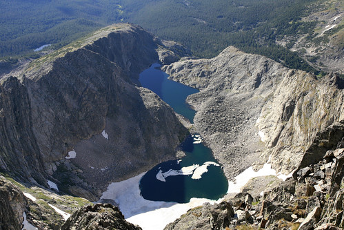
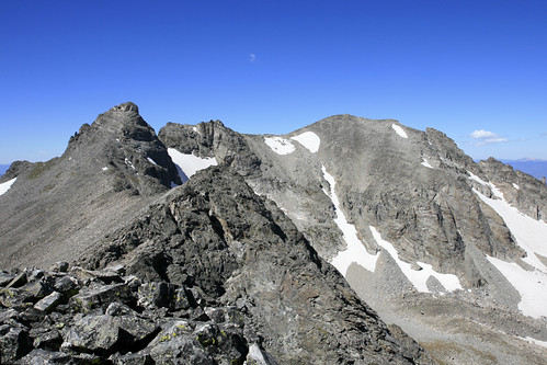
A short while later we were back on less vertical ground, just below the cliffs that block access to the summit. After a little route-finding, we solved 'the mysteries of the summit cliff,' as Gerry Roach put it, and scrambled to the summit. It was a little after 10:30. I thought we might see the fake-ass mountaineers coming up the North Face, but I had overestimated them and they did indeed bail on Navajo. We could see them making their way back down the ridge. From the summit we could see our approach from earlier that morning: Long Lake, Lake Isabelle, plus the unnamed lake where we left the trail. We also had spectacular views of Shoshoni Peak and Isabelle Glacier (far left).
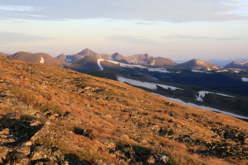
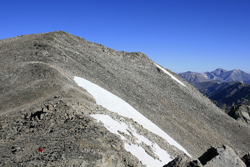
After lunch we started back down, now headed east towards Airplane Gully: our descent route. At the lowpoint above the gully we ran into two other climbers with less gear but more fortitude. They were on their way to climb Navajo and we exchanged info on our respective routes. Since it was an absolutely perfect day and still quite early, we decided to add some extra credit and climb the highpoint of Niwot Ridge (13,023) before dropping down the gully. Half an hour later we were there, looking back towards Navajo and Apache:
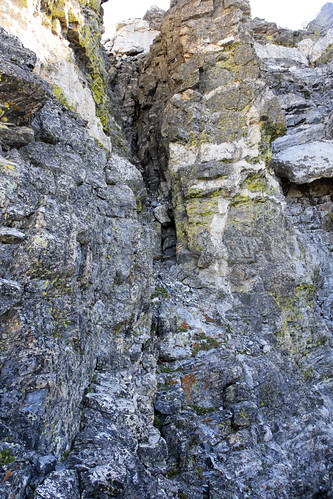
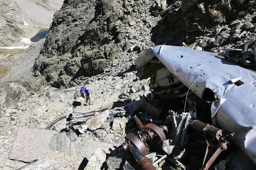
Airplane Gully is so-named because of a crash that occurred there on January 21, 1948. A C-47 traveling from Denver to Grand Junction crashed in bad weather and all three aboard were killed. It took four months to locate the crash which is mostly near the top of the gully, though bits and pieces are strewn for a long way down the mountain. Here Laura passes below the main wreckage:
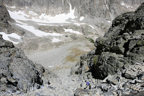
Aside from the cool wreckage, Airplane Gully really sucked. It was loose scree and steep talus all the way down. All the previous climbing had been difficult but still very enjoyable; this was nothing short of miserable. Thankfully it was only our descent route; we only had to do it once.
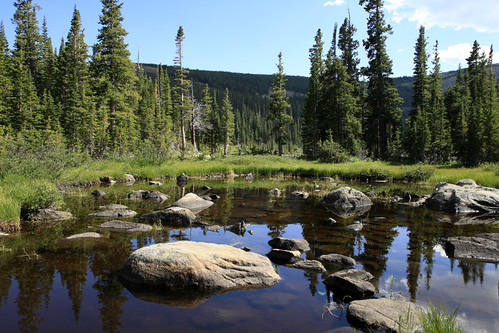
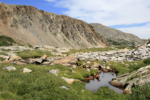
We finally made it back to the Isabelle Glacier Trail and our toes, feet, knees, and most other body parts were happy to be back on luxurious trail and solid ground. We passed some beautiful tarns, but saw no beasts. Perhaps the hordes of people out for the day scared them off.
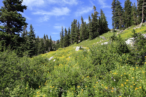
The alpine wildflowers are all done for the year, but there are still many subalpine flowers in the bloom.
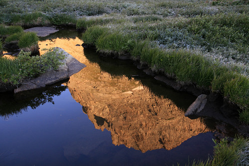
After a few photos we hustled down the trail, very much ready to be done hiking. Soon after passing this pretty pond we got back to our car, a little after 3:00pm. After the requisite push-ups in the parking lot, we headed to Boulder for some much deserved beer and burgers at our beloved Southern Sun Brewery.