
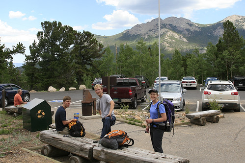
After meeting up with our friend Aaron, we started hiking at 3am, which is considered the standard starting time for the Keyhole Route. It's recommended to start this hike anytime between 1:00 and 5:00am. Because Longs Peak is substantially higher than the surrounding mountains, it regularly attracts foul weather. By leaving so early, you minimize your chances of being caught in the quite common afternoon thunderstorms that make the exposed upper sections very treacherous when wet (not to mention avoiding the very real threat of lightning strikes). It's over 15 miles roundtrip, with at least 3 hours or so spent past the Keyhole: not the place you want to be caught in a storm.
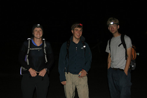
As our level of fitness was substantially higher than a lot of those attempting the hike, we passed at least a dozen people by the time we got to the awesomely named Goblins Forest. Once we got above treeline, you could see the glow of headlamps for miles ahead, as people snaked their way up the mountain. Sometime after 4:00am Laura spotted a herd of elk in a high meadow as we passed near them. While they were very difficult to see, it was an incredible feeling to be out so early, and in the company of wildlife. We passed many more people on our way to the Boulderfield: quite a few who were struggling mightily and had probably never been hiking before, nor been acclimated to high altitude.
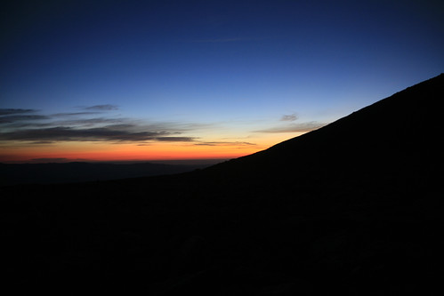
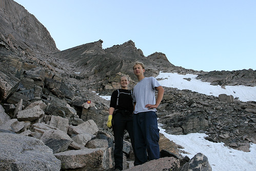
We reached the Boulderfield at 5:30am. There was a warm vibrant glow beginning to appear on the horizon: the sun would soon be up. The shoulder of Mt. Lady Washington blocks the full view of the horizon below:
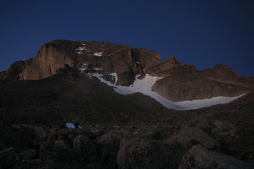
Longs Peak was glowing as the early morning light illuminated its east face. It was becoming much easier to see, just as the climb was about to get more difficult.
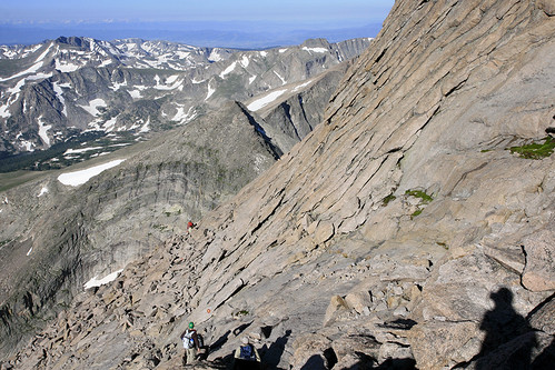
As we approached the Keyhole, we were greeted by the first rays of sunshine. Once through the Keyhole, the route follows along the west side of Longs Peak on the Ledges, an exposed section of broken ledges above steep rock slabs. We would be in shade the rest of the way to the summit, as the mountain blocks the sun here until the afternoon.
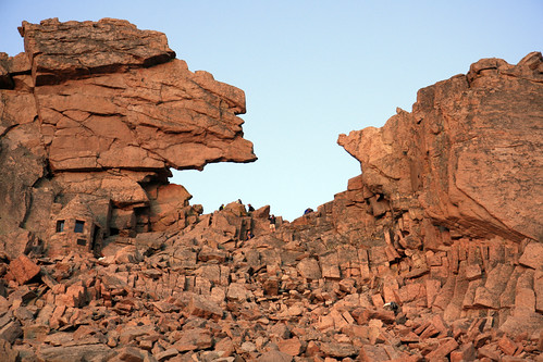
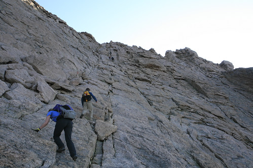
At this point the route is marked by 'bulls-eyes' painted on the rock, as the best route is not always obvious. While Longs is rated as one of the more difficult Class 3 14ers, it's still far easier than many mountains where there is no established or marked route. At the end of the Ledges, you enter the Trough.
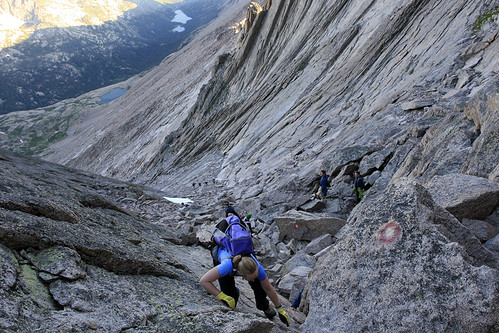
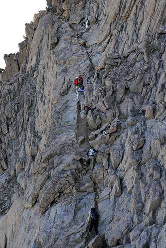
Laura and I are at the beginning of the Trough above. After climbing over 700 vertical feet up the Trough, you reach the crux: the hardest Class 3 hiking on the route. Hikes are graded on a scale of 1-5 with 1 being hiking on a trail and 5 being technical rock-climbing (with decimal points added above 5 to denote difficulty). Class 3 is generally climbing where you need to use both your hands and legs. You could use a rope (we passed two people on a guided climb that were roped up), but it isn't necessary. Longs Peaks is rated as Class 3+ by some. All of us agreed that the hike was easier than we thought it would be; it seems they try to scare the less experienced people (rightfully so) that shouldn't be climbing. On average, 2 people die each year on Longs Peak, usually due to falls. Here Laura scrambles up the crux:
After exiting the Trough, you traverse the Narrows, a narrow exposed ledge with a 1000+ foot sheer drop on your right. As the Narrows open up you enter the Homestretch, the last scrambling to the summit: roughly 400 more vertical feet.
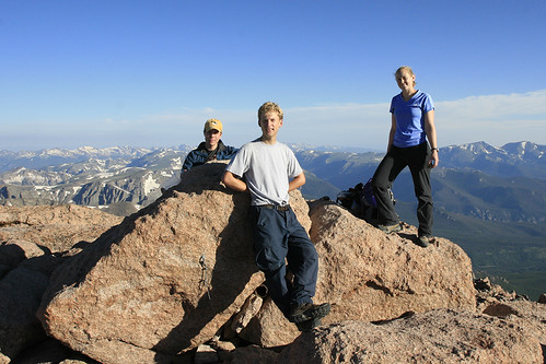
We reached the summit at 7:30am, long before most people, and before it was crowded.
After some exploring on the relatively flat, boulder-filled summit, and a strange early morning "lunch," we began our journey back down at around 8:30am.
On our way back down the Homestretch (above), we had to constantly navigate the throngs of people climbing up towards the summit. Here is a view of the Narrows on the way back:
The crowds really intensified once we we got back to the Trough, as there were quite a lot of people unsure of how to execute the crux move.
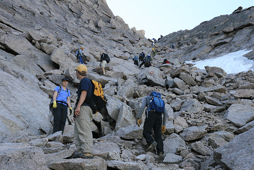
We got back to the Keyhole around 9:45, and set our sights on Mt. Lady Washington. After abandoning our climb last time because of stormy weather, we were determined to tack on some extra elevation and difficulty to this hike. Thankfully for us (and all the people still approaching Longs in the Boulderfield), there wasn't a cloud in the sky.
We dropped down from the Keyhole, and made our way to the outhouses in the Boulderfield.
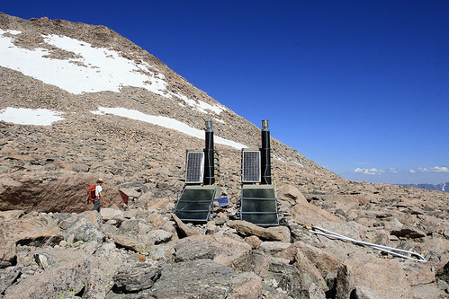
Now you may be wondering: why am I looking at a picture of outhouses? Well, these are not your ordinary outhouses. Because they aren't in the ground!!! You walk up a few steps to get in. Once inside, the wall only comes up to your chest, and there is no roof!!! Most definitely the best view I've ever had from a toilet. We think the waste must be transported out, as they are not permanent, and therefore I imagine, have no lasting effect on the area. Out of my abundant kindness, I'll spare you the photos of people in the outhouse.
Now, there is one other interesting thing about these outhouses. A bad-ass marmot lives here!!!
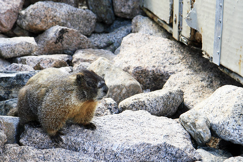
But, not only does this marmot seem to reside underneath the outhouses, he happily eats his residence!! He was not at all shy about munching on the outer walls.
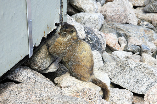
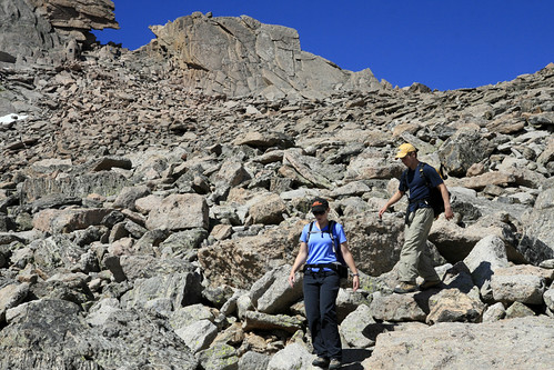
Either the wood is quite tasty, or this marmot has a vendetta against the National Park Service. I'm rooting for him either way! After exhausting the patience of my companions with my marmot watching, we set out to finally climb Mt. Lady Washington, which is on the east side of the Boulderfield.
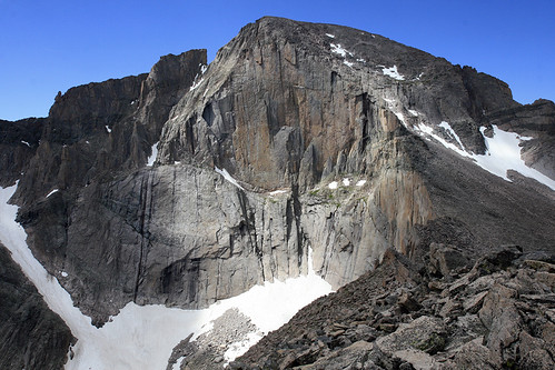
This is a view of Longs Peak from the summit of Mt. Lady Washington, almost a thousand feet below the summit of Longs. You can see why you must encircle most of Longs Peak in order to climb it. The east face is 2,000 feet of sheer rock known as the Diamond. It can be climbed, but only as a technical rock-climbing route.
After another early lunch (it was only a little after 11am), we started the long descent down to Chasm Junction and a very appreciated (by our legs) return to maintained trail. We reached the Longs Peak trailhead just before 2pm after a mostly uneventful trip back. It's not everyday that you want eat to dinner and go to bed at 2 in the afternoon.
You guys are amazing! Thanks for sharing. The only way I'd wake up that early for a mountain is if it were made out of chocolate :)
ReplyDeletethis is totally awesome. 1:15 is even earlier than i wake up for the birds. congrats!
ReplyDelete