
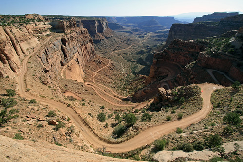
We drove slightly north of Moab, before heading west and then south towards the Island in the Sky district of Canyonlands. This section of the park has a paved road that weaves along the mesas, with views of the many canyons leading to the Colorado River and the Green River. After entering the park, we passed this view of Shafer Canyon Road, the slow way back to Moab:
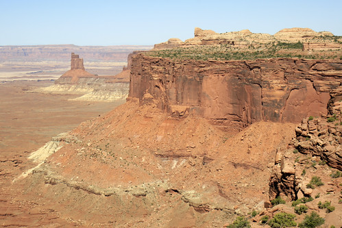
A quick scan of the warning sign at the beginning of the road disavowed me of any interest in driving down it a little ways. Thankfully there are many easily accessible views from the paved road. At Grandview Point we could see the White Rim level, the 100+ mile White Rim 4WD Road, and the Colorado River - many geologic levels below us in the distance:

The great expanse of canyons was simply mind-boggling. From our perch atop the mesa, the sandstone cliffs below looked impenetrable. There are very view places where a trail (or road) is able to descend to the White Rim, the next major plateau.
We stopped on the road to Upheaval Dome to admire this massive side canyon leading to the Green River:

Canyonlands is broken into 3 unconnected districts by the two major rivers that flow together in the park. Island in the Sky is the northern part of the park, bordered by the Colorado River to the south and the Green River to the west. The Needles district is south of the Colorado, and The Maze is east of the Green River and north of the Colorado (after the confluence of the rivers). Most of the park is inacessible except for on foot. The majority of paved road is in the Island in the Sky area. There are no paved roads in The Maze.
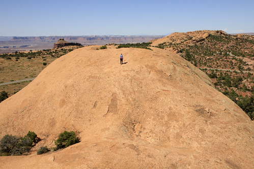
Further along the road to Upheaval Dome, Laura and I stopped for a quick hike to the top of Whale Rock. Whale Rock is a nice smooth inviting rock that kind of looks like a whale! What an appropriate name! After a fun race to the top and some photos, we returned to the car, and a couple of minutes later were at the end of the road.

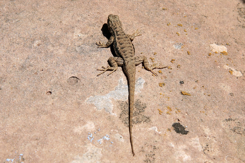
After a quick hike to the Upheaval Dome overlook, we zipped back down the road. I caught this lizard a short while later at another viewpoint.
Our last stop was the Green River Overlook before heading out of the park. We could see the expansive White Rim clearly, the Green River far below, and the very distant Maze. We stopped for a quick lunch before heading back to Moab and then south to Arizona.

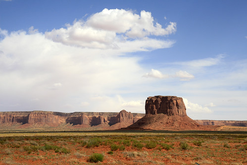
We still had over 300 miles to drive before we got to Flagstaff. We would be staying with our friends Greg and Ingrid for a few nights while we explored the Grand Canyon and checked out northern Arizona. On the way south we passed through the Monument Valley area:
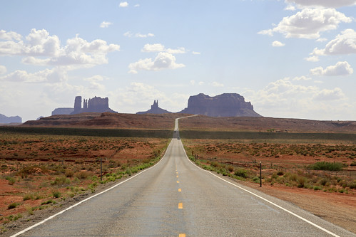
I wish we had more time on this part of the drive, as we took a few quick photos and continued on.
We got to Flagstaff just in time for dinner with Greg at the very interesting Mountainaire Tavern. Tomorrow would be our rim-to-rim hike of the Grand Canyon, the most anticipated part of our trip.
Hey James, When are you gonna post your Grand Canyon photos?
ReplyDelete